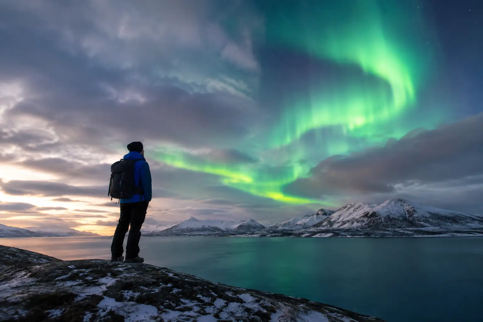
A cloudy forecast aurora success example is not a story about ignoring the weather. It is a story about reading the forecast at the right scale. A traveler in southwest Iceland sees 80% cloud cover for the region, assumes the night is lost, and stays at the hotel. Another checks the hourly cloud map, sees a narrow clearing moving across the south coast after midnight, and drives 20 minutes to an open shoreline. At 12:45 a.m., a bright green arc appears through a clear gap and strengthens for 15 minutes.
Both travelers saw the same general forecast. Only one treated it as a changing probability rather than a final verdict.
Why cloudy forecasts can still produce aurora success
Cloud cover is one of the most decisive parts of an aurora forecast because even a strong display is difficult to see through thick clouds. But a regional cloud percentage is not the same as a sky report for the exact road pullout, beach, cabin, or fjord where you will stand tonight.
Weather models divide the atmosphere into grid cells. They estimate cloud amount across each cell and update as new observations arrive. In mountainous places, near coastlines, and during unsettled Arctic weather, conditions can differ dramatically over short distances. One valley can be overcast while a nearby headland has a wide opening toward the northern sky.
That does not mean clouds are irrelevant or that travelers should drive blindly into bad weather. It means the useful question changes from “Is it cloudy?” to “Where is the clearest practical viewing window, and when will it be there?”
Aurora activity has its own timing. Solar wind may support visible northern lights for several hours, or it may improve suddenly when the interplanetary magnetic field, known as IMF Bz, turns south. A cloud break that lasts 30 minutes can be enough if it overlaps with active aurora conditions. Conversely, a completely clear sky does not guarantee a show if solar activity is weak.
The real-world scenario: a clearing beats the regional forecast
Imagine a couple based near Vik during an Iceland road trip. At dinner, the area forecast calls for extensive clouds and light showers. The KP Index is moderate, which is encouraging but not decisive. They could reasonably decide to go to bed.
Instead, they look closer. The cloud forecast shows a broken band moving east, with clearer intervals expected near the coast between 11:30 p.m. and 1:00 a.m. The wind forecast is manageable, roads are open, and there is no warning that makes travel unsafe. They choose a familiar nearby location with a broad view north, keep warm clothing in the car, and set a firm turnaround time.
At 11:40 p.m., the sky is still mostly covered. They wait rather than moving constantly. A small opening develops low in the north, revealing stars. Ten minutes later, a faint green band becomes visible. The couple would not call it an all-night spectacle, but they see a distinct aurora arc, photograph it, and return safely before the next shower arrives.
This is a successful cloudy-night strategy because the decisions were disciplined. They did not expect a perfect sky. They did not travel far in deteriorating conditions. They identified a short, local opportunity and were ready when it arrived.
What made this cloudy forecast aurora success possible
Several conditions had to line up. None of them alone would have been enough.
Local cloud detail
The broad forecast was mostly cloudy, but “mostly” still allowed breaks. Hour-by-hour cloud maps were more useful than a daily weather icon because they showed movement and the likely timing of the clearer band. Look at total cloud cover first, then lower, middle, and high cloud layers when available. Low cloud and precipitation usually cause the biggest visibility problems, while thin high cloud may still allow a bright aurora to show faintly.
Cloud maps are forecasts, not guarantees. Check them again close to departure. If a clearing arrives earlier or later than predicted, adjusting by even 20 minutes can matter.
A useful space-weather setup
The aurora requires energy from the solar wind interacting with Earth’s magnetic field. KP is one indicator of geomagnetic disturbance, but it is not a live visibility forecast for your exact location. A moderate KP can produce a memorable display in Iceland, northern Norway, Finland, Alaska, or Canada when the sky is dark and clear enough.
Look for the broader picture: solar-wind speed, density, and IMF Bz. A sustained southward Bz is generally favorable because it allows solar-wind energy to couple more effectively with Earth’s magnetic field. Rapid changes can also matter. The key is not to memorize every metric, but to recognize that conditions can improve after your evening forecast was published.
Dark skies and a view in the right direction
A cloud break is only useful if it opens toward the part of the sky where the aurora is visible. During quieter activity, the lights may sit low in the northern sky. A gap directly overhead is welcome, but a clear northern horizon is often more valuable. During stronger activity, the aurora can spread higher overhead and become visible through larger portions of the sky.
Moonlight is another trade-off. A bright moon does not stop the aurora, and a strong display can be spectacular with moonlit snow or mountains. But moonlight reduces contrast, especially for faint arcs. On a cloudy night with a weak aurora, darker conditions improve your chance of noticing the first signs.
Patience without overcommitting
The successful travelers waited through an imperfect sky because the forecast suggested the clouds were moving. They also had a limit. In winter, fatigue, wind, icy parking areas, and changing road conditions are real factors. A good aurora plan includes a decision point: wait for the next update, try a nearby clearer pocket, or call it a night.
How to make the same decision tonight
Start with the sky, not the headline. If your destination is under solid, persistent cloud with rain or snow expected for the entire night, chances are poor. Enjoy the evening and check again later. If the map shows patchy cover, moving breaks, or a clearer zone within a safe and realistic drive, you have a decision worth making.
Then check whether the aurora itself is active enough to justify the effort. AuroraVision combines cloud cover, weather, moon phase, solar wind, IMF Bz, KP, and a Live Aurora Score so you can compare the sky above you with the activity happening in space. The free app is especially useful on mixed-weather nights because a single KP number cannot tell you whether a clearing will coincide with a visible display.
Use the Best Time Tonight view as a planning tool, not a promise. If it highlights a promising window, prepare before it starts. Charge your phone and camera, bring a headlamp with a red-light mode if possible, layer up, and choose a legal, safe place to stop. Avoid blocking roads, private driveways, and narrow shoulders. In remote areas, tell someone where you are going and keep your fuel level well above empty.
For photographers, set up during the cloudy period rather than after the aurora appears. Focus manually on a bright star or distant light, stabilize the camera, and keep a microfiber cloth handy for moisture. Start with a wide aperture, a moderate ISO, and a shutter speed short enough to preserve structure if the aurora brightens. The best exposure depends on the camera, lens, moonlight, and the speed of the display, so review your first frame and adjust quickly.
When not to chase a break
A cloudy forecast is not an invitation to take unnecessary risks. Skip the chase when the road forecast is poor, visibility is dangerous, wind conditions are severe, or the potential clearing is too far away to reach safely. The same applies when cloud cover is widespread and stable with no realistic sign of improvement.
It also depends on your trip priorities. If you have five more nights in Tromso or a week around Fairbanks, conserving energy for a clearer night may be smart. If tonight is your only opportunity and a nearby break is forecast, a short, safe attempt can be worthwhile. The best decision is not always the longest drive. It is the one that balances probability, safety, and the time you actually have.
Read clouds as part of the aurora forecast
The practical lesson from every cloudy forecast aurora success example is simple: do not confuse an imperfect forecast with a failed night. Watch for cloud movement, identify small local windows, and compare them with current solar conditions. Be ready early, stay flexible, and let safety set the boundary.
A moving gap in the clouds may only give you a few minutes. Those few minutes can be enough to see the sky turn green - and to make the decision to step outside feel entirely worthwhile.